
Photo Courtesy : Yogesh Masuria
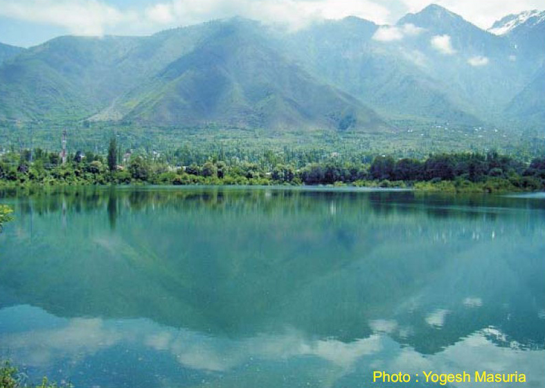
Wular Lake, the largest fresh water lake in India, is situated at a distance of about 40 Kms. towards north-west of Srinagar. It is said to be formed as a result of tectonic activity.
Wular Lake is about 189 Sq. Kms. in area which varies from season to season. It lies at an altitide of 1580 Mtrs. It has a length of 16 Kms. and a breadth of 10 Kms. Its maximum depth is 14 Meters. The deepest part of the Lake is known as Mota Khon which means Gulf of Corpses. The Sopore and Bandipora towns are located on its banks.
Jhelum river evacuates into the Wular Lake at Banyari, which is 40 Kms. from Srinagar and again separates at Ningli. The flood water of river Jhelum acts as a natural reservoir. The catchment area of the Lake is covered with coniferous forests, alpine pastures and orchards which add to the scenic beauty of the lake.
The Wular Lake plays a significant role in the hydrographic system of the Kashmir valley by acting as huge absorption basin for annual flood water. The Lake and its surrounding marshes have an important natural wildlife. The Lake is the home to as many as 50 species of aquatic animals and several migratory and resident birds which include waterfowl species such as Little Egzet (Egretta garzetta), Cattle Egzet (Bubulcus ibis), Shoveler (Anas clypeata), Common Pochard (Aythya farina) and Mallard. Birds like Marbled Teal (Marmaronetta angustirostris) and Pallas´s Fish-eagle (Haliaeetus leucoryphus) are species listed in the Red List of IUCN. Many terrestrial bird species observed around the lake are Short-toed Eagle (Circaetus gallicus), Little Cuckoo (Piaya minuta), European Hoopoe (Upupa epops), Monal Pheasant (Lophophorus impejanus) and Himalayan Pied Woodpecker (Dendrocopos himalayensis albescens).
In 1986, the lake was designated as a Wetland of National Importance under the Wetlands Programme of the Ministry of Environment and Forests, Government of India for the purpose of conservation and management. In 1990, it was assigned as a Wetland of International Importance under the Ramsar Convention.
The rivers Bohnar, Madamati and Erin from the mountain ranges and the rivers Vitasta (Jhelum) and the Ningal from the south bring hundreds of tons of silt into the lake every year. This rampant siltation and the human encroachments have devastating effects on the lake.
[Sources: ‘Indianetzone-Geography of India’, ‘SAVE’ and ‘Project Zaan Archives’]